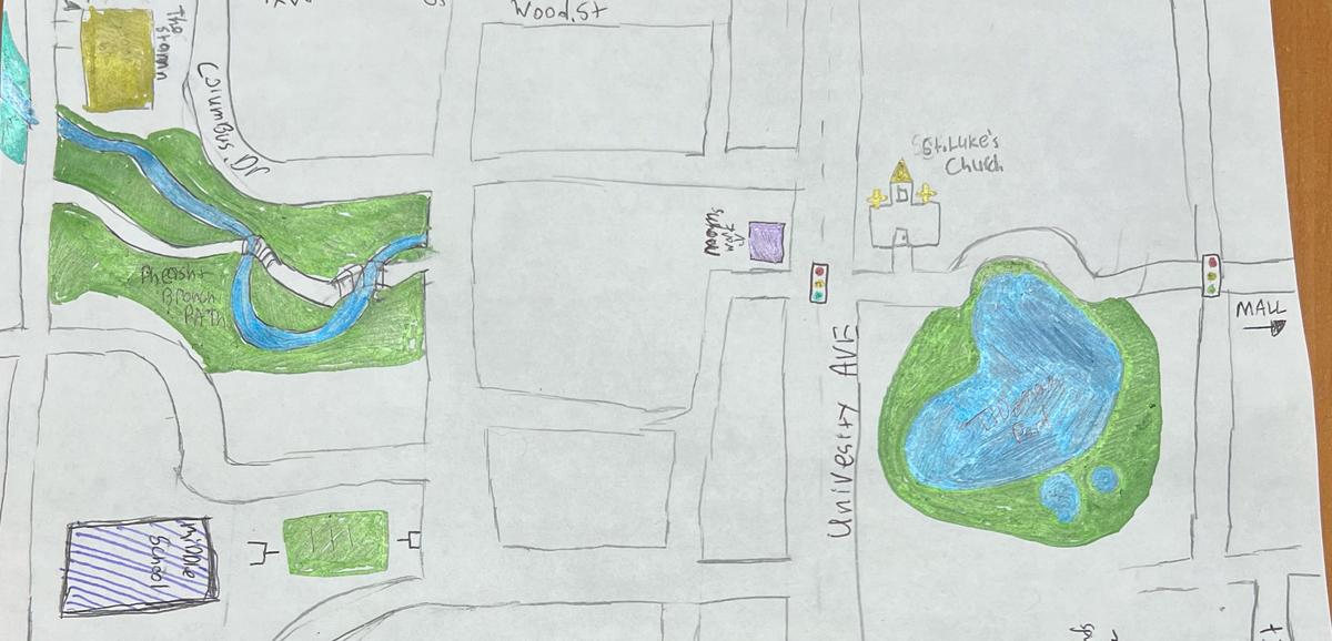
In GIS 2552: Mapping Our World, Dr. Joseph J. Kerski (Geography) uses the assignment to build community in the classroom, foster discussion about map fundamentals, and “anchor the concept that humans are fundamentally tied to space and place—that place is part of what makes us human; that memories are linked to maps, and that these maps are in our brains as detailed large-scale maps.”
Kerski explained that, “Mapping Our World invites students to investigate key 21st Century issues in their communities, region, state, country, and the globe using spatial thinking and exciting, interactive maps to empower them to be critical and spatial thinkers regarding issues such as natural hazards, equity, population change, water, energy, supply chain management, human health, and others, and through understanding, give them tools to take action and to use them in their future careers.”
When students are asked to sketch from memory their childhood neighborhood, they may use pencil, pen, colored pencils, or whatever manual tactile methods they would like to utilize. The students think about what they wondered about as children or teenagers, what they dreamed about as they walked to the library or to school, or what they played in this backyard or on that street.
“The detail of the students’ memory, like for all of us, is remarkable,” Kerski stated. “The maps are finely illustrated, and it makes for great discussion about mapping, place, space, scale, change over space and time, and memory.” The class also considers what is important to include and to leave out, as well as what symbols they chose.
A former student in the course and current TA of the course, Devin Rhoades (Environment, Sustainability, and Geography & Geographic Information Science ’24), reflected, “A key takeaway from this assignment was the beginning of thinking spatially and learning to visualize geographic locations in a 3D realm / perspective. I realized the difficulty of remembering the placement of different locations with respect to neighboring locations (I also realized how bad the urban planning was.) The absolute biggest takeaway I found was visualizing the placement of your living in the town in relationship to different areas of the town.”
Once students have completed their map, they take a picture of their results and post them for others to comment on. Students then reflect on how their map was similar or different from the map of a classmate. Kerski noted that “Many students get so engaged in this activity that they start looking at and reflecting on other maps as well.”
Kerski reflected, “The high level of student engagement is always wonderful to see. [The assignment has] affirmed my belief that a personal experience with mapping and with place and space is a part of every human’s experience. It has also helped me re-recognize the diversity of childhood places and experiences. Some experiences may not have been positive, such as the mean dog down the street or poison ivy we may have gotten from that field, or the time we fell off the bicycle here or there, but they are all a part of our experiences and all a part of place.”
Rhoades similarly asserted, “Mapping Our World is a severely underrated course in my opinion. It was actually the course that sparked my interest in a GIS minor which I eventually changed to a major.
“The course has to be the definition of wonder. You wonder how to recreate your hometown, different web applications, how a guy was able to simulate a traffic jam on Google Maps, and the range that you can create a map to better understand geography or different statistics / scenarios. You also wonder why people create bad maps intentionally, which then leads to wondering how you can make it better.
“I sincerely value this course and use different aspects of it in my daily life and in conversation with family or friends to help them think spatially too. I couldn't be happier to close my undergrad experience by working as a TA in this course. I believe that says something.”
